October 31, 2025 | 01:50 GMT +7
October 31, 2025 | 01:50 GMT +7
Hotline: 0913.378.918
October 31, 2025 | 01:50 GMT +7
Hotline: 0913.378.918

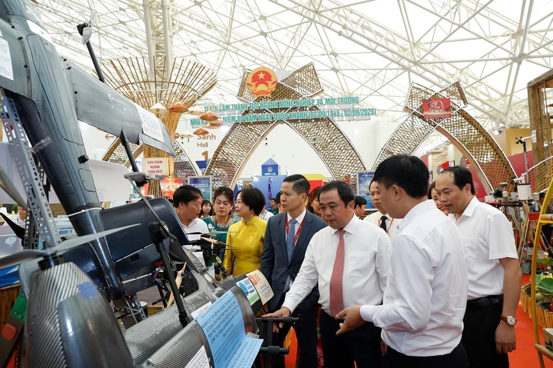
Acting Minister Tran Duc Thang visits the unmanned aerial vehicle model researched and invented by scientists of the Institute of Geodesy and Cartography. Photo: Khuong Trung.
The story of technological devices "made in Agriculture and Environment" did not begin with resounding success but with failures and concerns of a group of young engineers at the Institute of Geodesy and Cartography.
In 2014, when the concept of unmanned aerial vehicles (UAVs) was still quite unfamiliar in Vietnam, Master of Science Luu Hai Au, Director of the Center for Geodetic Informatics and Mapping (Institute of Geodesy and Cartography, Ministry of Agriculture and Environment), and his colleagues embarked on the journey of conquering technology.
The first self-made UAV prototypes constantly encountered problems, many crashing before even taking off. Yet it was through these failures that the group gradually mastered the technology. They explored, researched, developed control software, integrated the GNSS-VRS positioning system, and step by step perfected a vertical take-off and landing fixed-wing UAV model (VTOL).
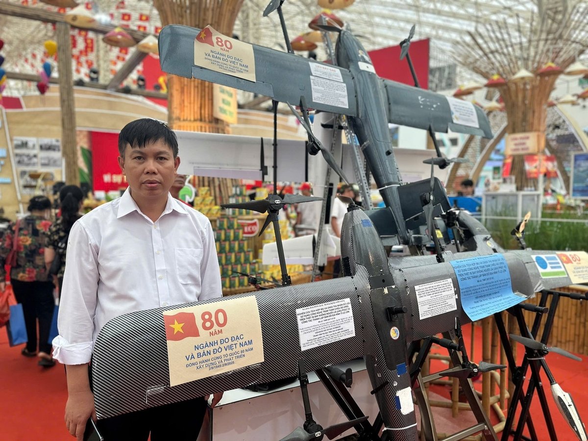
Perseverance paid off. By 2018, the group had succeeded in manufacturing five UAV VTOL versions. With a wingspan of 2.4 meters, continuous flight capacity of 110 minutes, and a speed of up to 80 km/h, these UAVs proved the capabilities of Vietnamese engineers.

Master Luu Hai Au introduces the vertical take-off and landing flight equipment developed by the team. Photo: Nguyen Thuy.
What was special was that this domestically produced product was not only much cheaper than imports but also suitable for Vietnam's actual conditions. They required no runway, could take off and land easily in difficult terrains such as forests, mountains, urban areas, or wetlands. This was a crucial turning point, opening up a new path for the country's civil UAV industry.
Ten years later, the outcomes of persistent research were exhibited at the national achievement exhibition "80 years—Journey of Independence—Freedom—Happiness." The Ministry of Agriculture and Environment booth impressed visitors with the appearance of three core devices: UAV-VTOL, unmanned surface vehicle echo sounder (USV Echo sounder), and, particularly, the UAV swarm system.
If before, each UAV operated independently, now, thanks to swarm flying technology, multiple devices could simultaneously perform tasks on a single control software. This created a revolution in work efficiency.
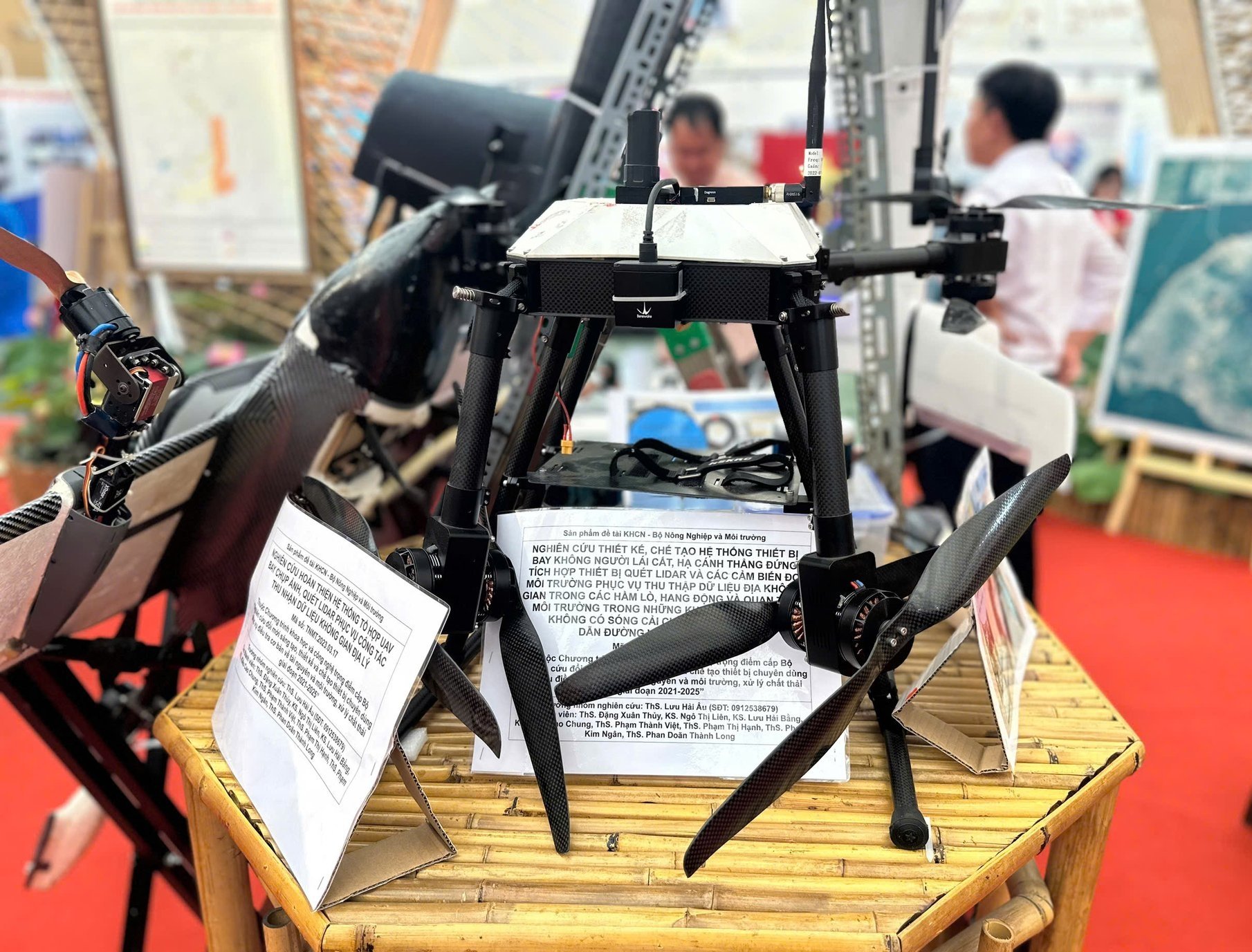
In 2022, the research group conducted lidar scanning tests in Ha Tinh and Quang Binh. Four UAVs simultaneously surveyed 4,000 hectares in just one day, tenfold shortening the time compared to traditional methods. "Previously, this work required 10 days and dozens of workers, but now only one operator is needed, with all data automatically transmitted to the center in real time," Master Au excitedly shared.

UAV conducts lidar scanning flights to collect geospatial data. Photo: Nguyen Thuy.
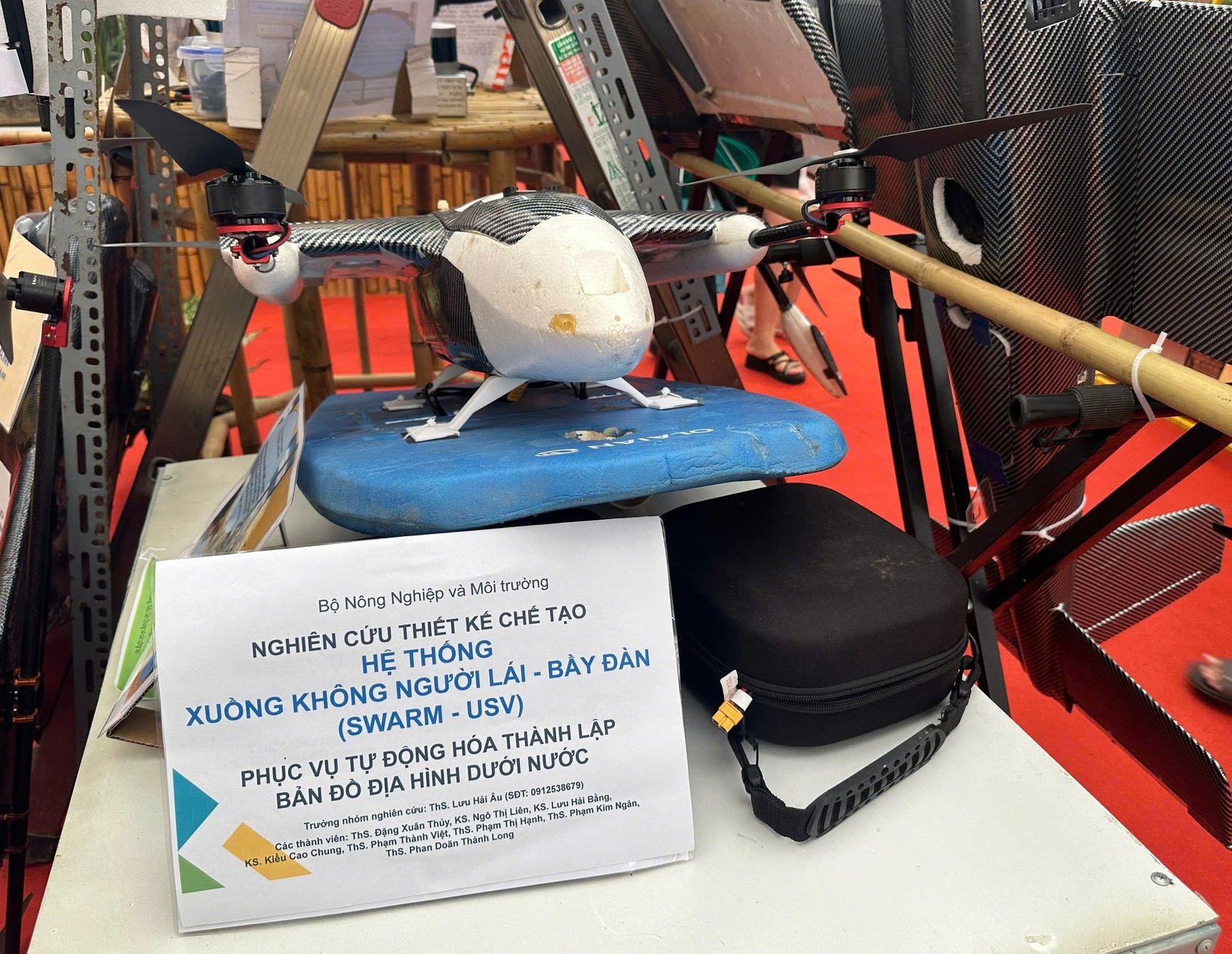
Beyond the aerial field, the group expanded into water environments by creating unmanned surface vehicles (USVs) for monitoring and sampling. These boats could operate in dangerous or restricted areas inaccessible to humans, such as shrimp ponds, aquaculture lakes, or deep rivers. They could collect water and sediment samples, measure echo depth, and send precise data back to the center.
These devices have been widely applied in practice. They were used for echo sounding at Mong Duong 2 Thermal Power Plant, lidar aerial mapping for the Ninh Hoa - Buon Ma Thuot expressway project, and mapping wetlands in the Long Xuyen Quadrangle.
The research group continues to nurture an even more ambitious project: a swarm robot system for planting mangrove forests, scheduled for implementation from 2026 to 2029. This project reflects the aspiration to master advanced technology and address urgent issues in the agricultural and environmental sectors.

Unmanned surface vessel swarm system serving automation in underwater topographic mapping. Photo: Nguyen Thuy.
"Robots can replace 106 workers planting trees each day," scientist Luu Hai Au confidently said. This system is designed to automate the entire afforestation process. The robots will autonomously move to designated locations, dig holes, plant seedlings, fill soil, and upon completion, generate 3D maps to monitor tree growth. Thanks to specialized designs, these "smart mechanical farmers" can effectively operate in mangrove and muddy environments where human access and labor are extremely difficult.
If successful, this technology will mark a major breakthrough in mangrove afforestation in the Mekong Delta and the central coastal region, which are heavily affected by climate change and erosion. The system will not only help protect the environment but also contribute to sustainable livelihoods and strengthen the country's "green shield."
This is not just a story about technological devices but also about the aspiration to master science, master the future, and advance the agriculture and environment sector further, shoulder to shoulder with technological powers worldwide. The exhibition booth did not simply introduce products but also told a story of passion and dedication, a journey that has turned technological dreams into reality.
Translated by Huong Giang

(VAN) The collaboration between local agricultural extension forces and businesses is the foundation for effectively implementing the one-million-hectare high-quality, low-emission rice project.

(VAN) Minister Tran Duc Thang affirmed that the Ministry of Agriculture and Environment remains steadfast in its goal of green and sustainable development, laying the foundation for double-digit growth in the 2026-2030 period.

(VAN) Sustainable rice production requires a comprehensive soil management strategy, the application of technology, value chain linkages, and integrated economic, social, and environmental solutions.

(VAN) Kim Anh commune (Hanoi) is shifting to biosecure livestock farming to improve product quality and increase sustainable economic value.

(VAN) Early on October 30, all relief supplies from the Russian Federation arrived at Noi Bai Airport and immediately transported to Hue City during its peak of the flooding.

(VAN) According to Deputy Minister Nguyen Hoang Hiep, just 20 days after the appeal was launched, Viet Nam received assistance from 30 countries and international organizations, with a total value of USD 9.7 million.

(VAN) SEAMAP and ROMONA sign a 2025 - 2028 Memorandum of Understanding, marking a new chapter in Viet Nam’s marine geodesy and positioning technology development.