November 8, 2025 | 16:41 GMT +7
November 8, 2025 | 16:41 GMT +7
Hotline: 0913.378.918
November 8, 2025 | 16:41 GMT +7
Hotline: 0913.378.918

Mr. Nguyen Tuong Vi, an officer of the Disaster Prevention Department (Sub-Department of Irrigation and Water Resources, Binh Dinh), is operating the disaster management software. Photo: V.D.T.
According to Mr. Nguyen Tuong Vi, an officer from the Disaster Prevention Department (Sub-Department of Irrigation and Water Resources, Binh Dinh), in October 2022, Binh Dinh authorities began developing disaster management software, which was officially put into operation during the 2023 flood season.
“The goal of the disaster management software is to digitalize disaster prevention and response data from localities and relevant departments, based on the ‘Four on-the-spot’ approach,” Mr. Vi explained. “Previously, data for disaster prevention and response existed, but it was scattered across different localities. Now, it is reorganized and integrated into the software, providing a comprehensive overview to facilitate more effective coordination.”
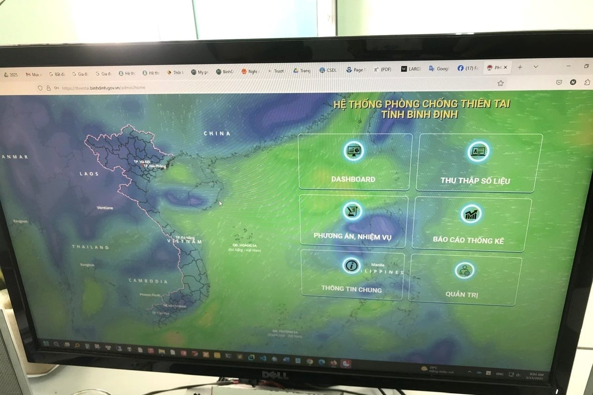
According to Mr. Vi, the disaster management software is built based on the latest data provided by local authorities, departments, and agencies across the province. The data reflects specific areas and the number of households at risk, depending on the severity level of the disaster. Binh Dinh’s disaster management software includes four storm scenarios and three flood scenarios. One scenario is designed for storms of level 8-9, another for levels 10-11, a third for levels 12-13, and a separate scenario for storms stronger than level 13.
For flood prevention and response, there are three scenarios: one for floods from alert level 3 to level 3+1 meter, another for floods from level 3+1 meter to historic flood levels on rivers, and a third for floods that exceed historic levels.
According to Mr. Ho Dac Chuong, Deputy Director of the Binh Dinh Department of Agriculture and Environment, the province’s disaster management software currently contains data on more than 405,000 houses, accommodating approximately 1.5 million residents. It can identify which homes and people, especially the elderly and children, need to be evacuated in the event of a storm or flood. The software also integrates data on local response forces at the commune and district levels, including community rapid response teams and armed forces such as police and military. In addition, the system pre-establishes disaster response command boards for each department, agency, district, and commune.

Disaster prevention system software of Binh Dinh province. Photo: V.D.T.
Regarding disaster response logistics, the software integrates data on available transportation and equipment such as trucks, excavators, and backhoes in each locality. It also tracks the current location of these vehicles, the businesses that own them, their operational status, and the contact information of the owners. For local logistics support, the software includes information on supply warehouses, equipment inventories, and the amount of food and essential goods stockpiled by localities in preparation for the storm season. Notably, the software also integrates centralized evacuation points, complete with coordinates, specific locations, and the capacity of each site.
According to Mr. Chuong, when authorities activate a disaster scenario, depending on the severity level, the system will display how many households need to be evacuated in each area, the supporting personnel assigned to evacuation efforts, where residents should be evacuated to, the means of transportation, which organization manages each vehicle, and how much food and supplies are currently available in the local warehouses. The system also indicates whether those supplies are sufficient for the evacuees. Currently, Binh Dinh’s disaster management software integrates information on approximately 1,900 centralized evacuation sites. The software can also analyze each site according to the type of disaster, helping localities proactively plan, as some sites may be safe during floods but not during storms.
“Depending on the disaster scenario, the software will provide detailed information on how each household may be affected, evacuation plans for pre-identified safe areas, the amount of food and supplies required for evacuees, areas expected to remain flooded or isolated for many days, and how to deploy personnel and vehicles accordingly,” Mr. Ho Dac Chuong noted.

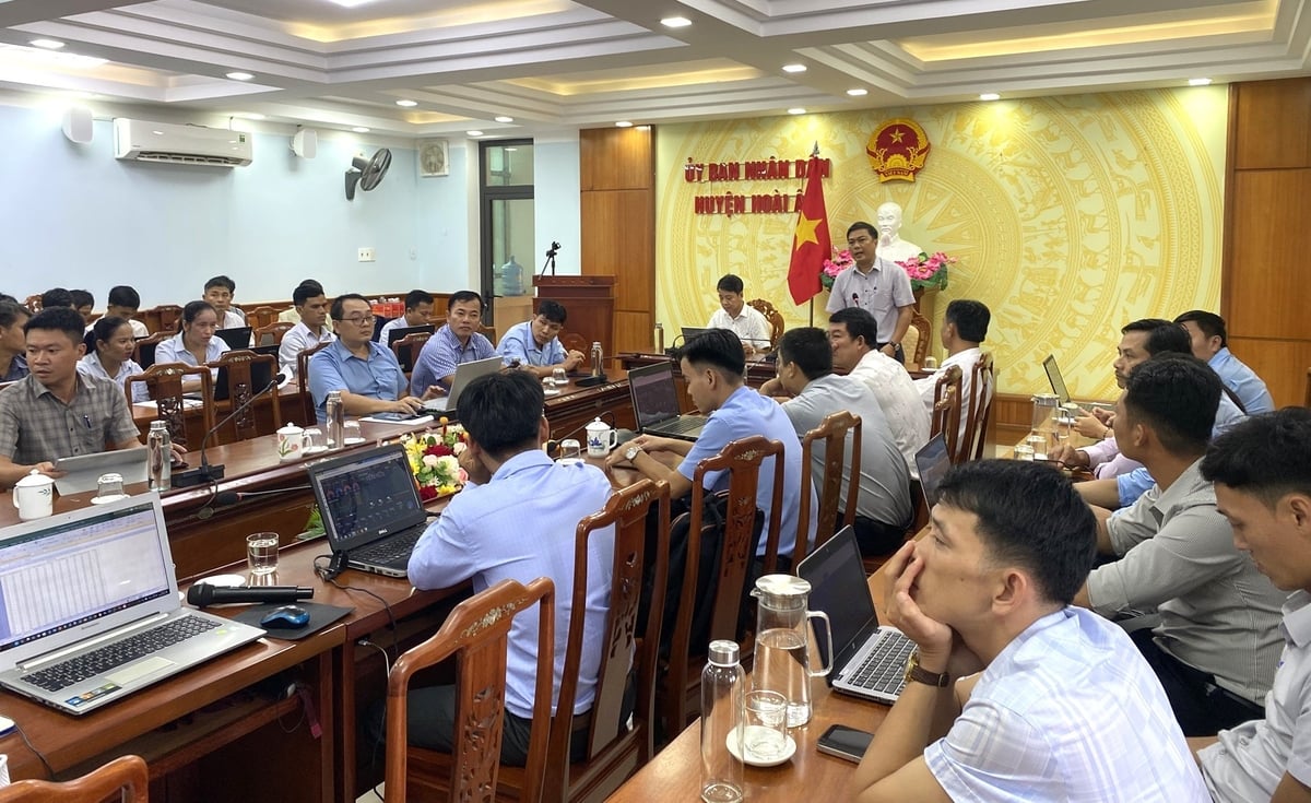
Training on how to use the disaster management software in Hoai An district (Binh Dinh). Photo: V.D.T.
According to Ms. Nguyen Thi Bich Phuong, Head of the Agriculture and Environment Office of Tuy Phuoc district (Binh Dinh), Tuy Phuoc is a low-lying area located downstream of the Kon and Ha Thanh river basins, and thus is frequently affected by deep flooding during the annual flood season. Many areas become isolated, severely impacting the lives of residents in the lower basin. In recent years, the development of transportation infrastructure through the district has further restricted flood drainage, making disaster recovery efforts more challenging.
Ms. Phuong also noted that since 2022, the Tuy Phuoc District People’s Committee has directed relevant agencies and localities to coordinate with provincial departments to build flood warning towers in communes such as Phuoc Thang, Phuoc Hoa, Phuoc Son, Phuoc Thuan, and Phuoc Nghia to alert residents and support disaster prevention. Additionally, flood monitoring cameras have been installed in Khuon Binh hamlet (Phuoc Thang commune) and Kim Dong hamlet (Phuoc Hoa commune) to provide real-time information for local authorities to take timely action when floods occur.

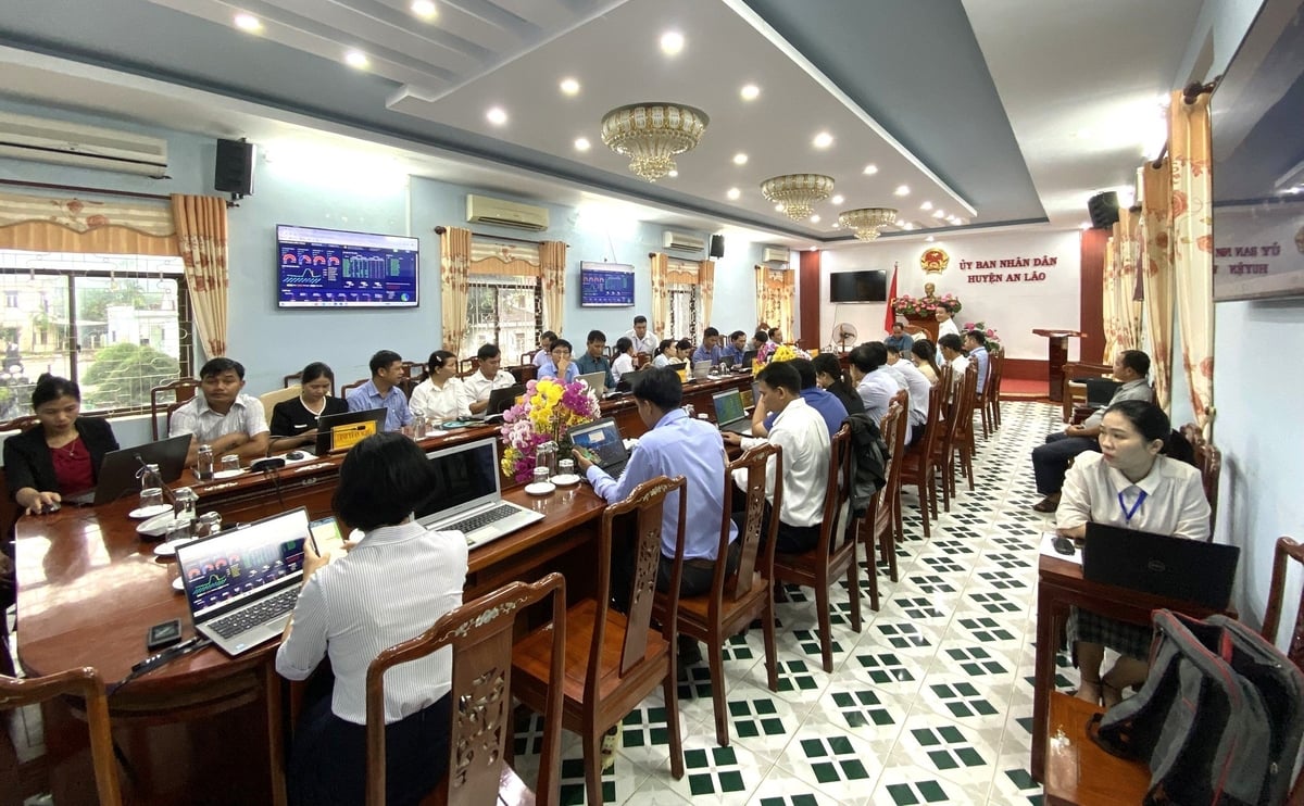
Training on how to use the disaster management software in the mountainous district of An Lao (Binh Dinh). Photo: V.D.T.
“Since 2023, the political system from the district level down to the commune level has been using the disaster management software to support disaster prevention and response in the area, which has helped minimize damage. Most notably, local authorities and functional agencies have been able to proactively review and identify households that need to be evacuated during severe flooding, as well as designate safe evacuation points,” shared Ms. Phuong.
According to Mr. Nguyen Van Hung, Vice Chairman of the People’s Committee of Phuoc Thang Commune - an area known as the "flood basin" of Tuy Phuoc district, Phuoc Thang is situated in a very low-lying region where even light rain can cause flooding in some areas, while heavy rain leads to widespread inundation.
When floods reach Alert level 2, the entire road system in Phuoc Thang becomes submerged. The commune has 9 hamlets, of which 6 are deeply flooded during such events: Tu Cung, Pho Dong, Luong Binh, Lac Dien, An Loi, and Dong Dien. These hamlets are frequently affected by tidal surges, so even after rainfall has stopped and water levels have receded in other areas, these villages often remain submerged for an extended period.

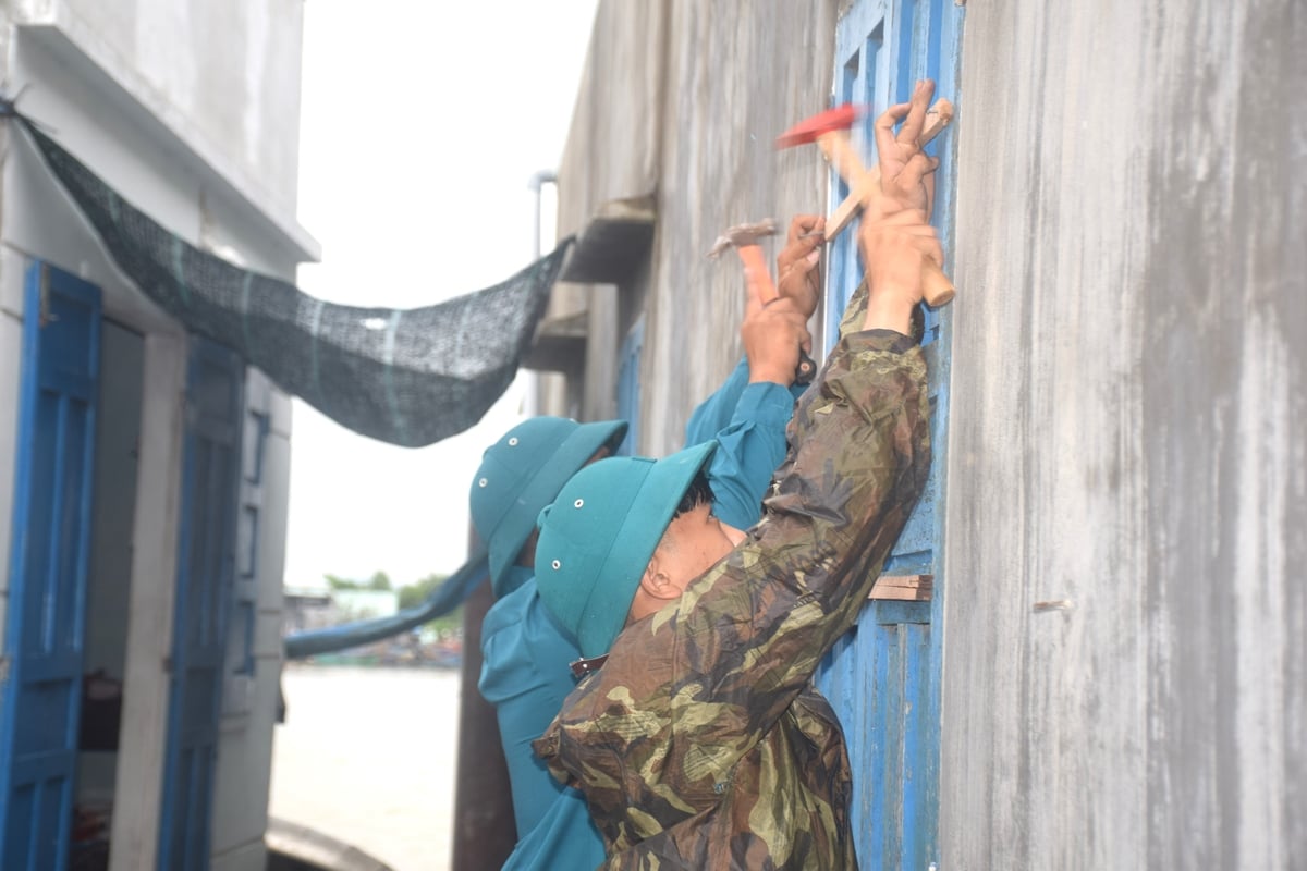
Armed forces in Binh Dinh assist residents in reinforcing their homes ahead of the storm. Photo: V.D.T.
“Before each storm and flood season, the commune government reorganizes the disaster prevention and control committee, assigns specific responsibilities to each member for designated hamlets, and implements an operational framework. When provincial authorities activate a disaster response scenario - depending on the severity level of a storm or flood, each member is responsible for carrying out evacuation procedures based on the data outlined in the scenario.
At the same time, they also conduct public awareness campaigns to discourage residents from unnecessary travel or working in dangerous areas, in order to minimize human casualties. All necessary actions are pre-defined in the disaster response scenarios, so we simply follow the plan, which makes implementation much smoother,” shared Mr. Nguyen Van Hung.
According to Mr. Nguyen Tuong Vi, an officer from the Disaster Prevention Department (Sub-Department of Irrigation and Water Resources, Binh Dinh), the current disaster management software in Binh Dinh only includes data and response scenarios for storms and floods, while the province frequently faces other types of disasters such as flash floods, landslides, and droughts.
“To integrate additional data for responding to other types of natural disasters, we have to rebuild the scenarios from scratch, which requires a significant amount of funding. Moreover, Binh Dinh Province is currently implementing a two-tier local government system by eliminating the district level and merging communes and provinces, so the software must be updated according to the new administrative units. The disaster management software is most effective when weather forecasts are accurate,” shared Mr. Nguyen Tuong Vi.
Translated by Phuong Linh

(VAN) The development of green, circular, and organic agriculture is becoming an essential direction for the Mekong Delta, helping farmers cut costs, boost profits, and build a sustainable production system.

(VAN) Eighty years of agriculture and environmental development in the Mekong Delta tell a story of constant adaptation and transformation - all driven by the shared goal of harmonizing production with environmental protection.

(VAN) Sustainable coconut cultivation is the key to achieving balance among three pillars: economic efficiency, ecological safety, and consumer trust.

(VAN) A wood pellet factory has been supporting forest growers certified under FSC standards to improve their income and promote sustainable forest protection.

(VAN) Associate Professor Dr. Pham Anh Tuan emphasized that clearly identifying target groups, production scale, and consumer markets is key to ensuring the sustainable development of Viet Nam’s coconut industry.

(VAN) More than 400 experts from domestic and international organizations attended the ACT Con 2025 conference, which aimed to connect technology developers with frontline conservation teams.

(VAN) Food irradiation technology is an innovative solution that extends shelf life and acts as a ‘golden visa’ enabling Vietnamese agricultural products to access the world’s most demanding markets.