November 10, 2025 | 12:41 GMT +7
November 10, 2025 | 12:41 GMT +7
Hotline: 0913.378.918
November 10, 2025 | 12:41 GMT +7
Hotline: 0913.378.918
Rising from hardship, thanks to the State’s investment and the tireless efforts of its staff, Vietnam’s forecasting and early warning science and technology has now reached a leading level in Asia. A reporter from the Vietnam Agriculture and Nature Newspaper interviewed Mr. Hoang Duc Cuong, Deputy Director General of the Vietnam Meteorological and Hydrological Administration (Ministry of Agriculture and Environment), to gain deeper insights into the sector’s development journey.
The short story “Quiet Sapa” was written around 1970, about 25 years after Vietnam’s independence. Does its content reflect a realistic picture of the work of hydrometeorological staff at that time?
Around 1970, the country was still facing great difficulties: the war had not yet ended, and the economy, as well as science and technology, remained limited. In my view, the young man depicted in the story may not represent the entire picture of the meteorological and hydrological sector, but he does provide an authentic snapshot of the work and circumstances of the sector’s staff during that period.
Meteorological stations on mountain tops, islands, and in remote areas were just a small part of a very rudimentary observation network, mainly located at strategic sites to serve storm and flood warnings or long-term climate studies.
Just as described in “Quiet Sapa”, hydrometeorological staff of that period worked with mostly manual or semi-mechanical instruments such as: pluviometers (manual rain gauges), liquid thermometers, aneroid barometers, mechanical anemometers, cloud observation tubes, compasses, and handwritten logbooks. There were no computers, no software for data processing. Everything was recorded by hand and calculated with slide rules or mechanical calculators.
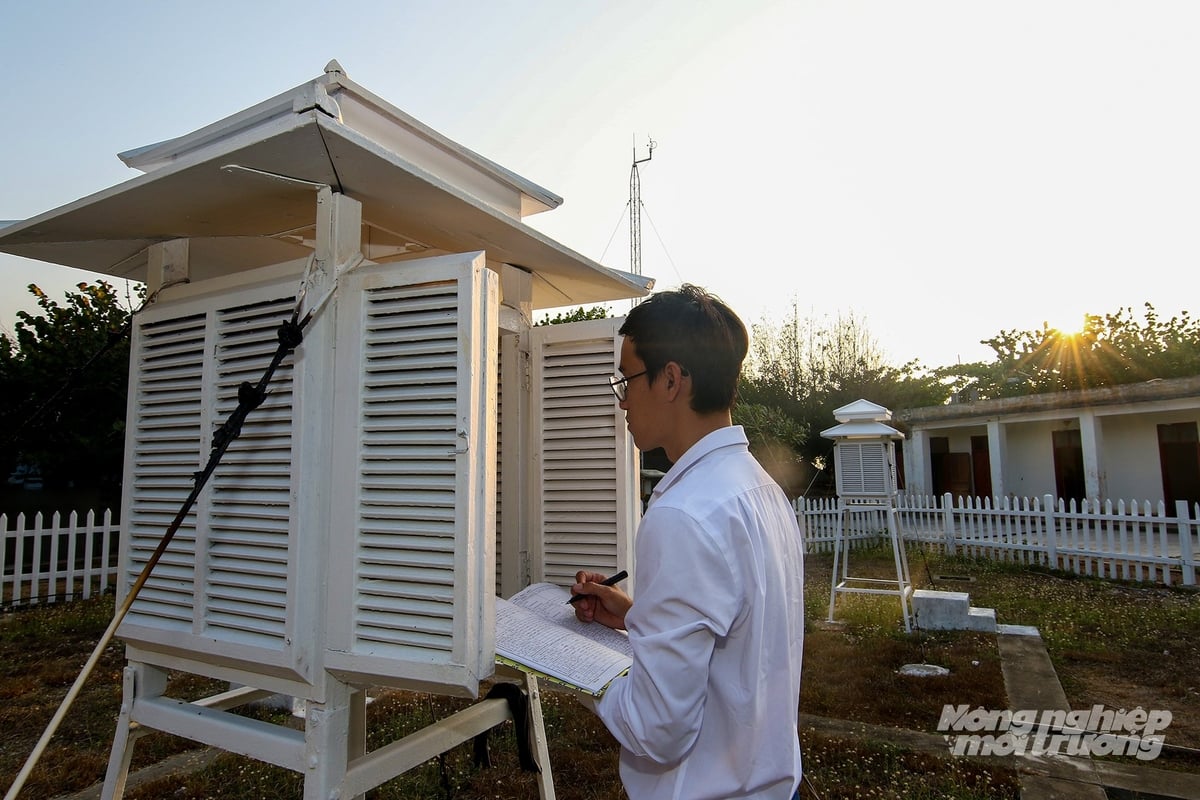
A technician collects data for hydrometeorological forecasting on Truong Sa Lon Island. Photo: Khuong Trung.
The hydrometeorological workforce was very limited. The number of staff formally trained at home and abroad was small, while most of those working at stations came from short-term training courses or learned on the job. Harsh working conditions, being far from families, and having low income and austere living standards made it difficult to attract and retain personnel in challenging locations such as Sa Pa, Bach Long Vi, or Co To. In many cases, just one or two staff members were responsible for an entire station, handling observations, recording, equipment maintenance, as well as communications and data reporting back to the center.
Weather forecasting and warning at the time relied largely on basic knowledge and practical experience. Observers had to memorize regional weather patterns and carefully monitor changes in clouds, wind, temperature, and air pressure to anticipate developments. Communication and the transfer of updated knowledge from central offices to remote stations faced many obstacles. In many areas, information was relayed only via Morse code telegrams or shortwave radios.
In the 1970s, Vietnam’s hydrometeorological observation network consisted of only a few dozen main stations and some auxiliary ones, sparsely distributed and not yet covering all climate zones. Data standardization and analysis were still done manually, so the time from data collection to the issuance of forecasts was prolonged, and accuracy remained limited.
However, looking at the broader picture, the sector at that time already had forecasting centers in major cities, where working conditions were more favorable, supported by experts and relatively modern equipment compared to the country’s overall context.
What stands out is that, despite hardship and scarcity, hydrometeorological staff still fulfilled their mission of maintaining a continuous observation system. Each of them believed that providing forecasts and disaster warnings was vital for production, national defense, and people’s livelihoods. At the same time, social recognition was a powerful source of motivation for their continued dedication to the profession.
Though written more than half a century ago, the short story “Quiet Sapa” still reminds us of the steadfast devotion and sense of responsibility of those working in the field of “weather forecasting.” A profession that might appear as simple as watching clouds and reading winds, but in reality represents the crystallization of knowledge, experience, patience, and deep passion for the work.
What steps must the process undergo to deliver weather forecasts and disaster warnings to the community, sir?
Many people often use the phrase “measuring the wind, counting the clouds” to describe hydrometeorological officers. In reality, this is only a very small part of the complex chain of work required to produce a complete forecast or disaster warning bulletin.
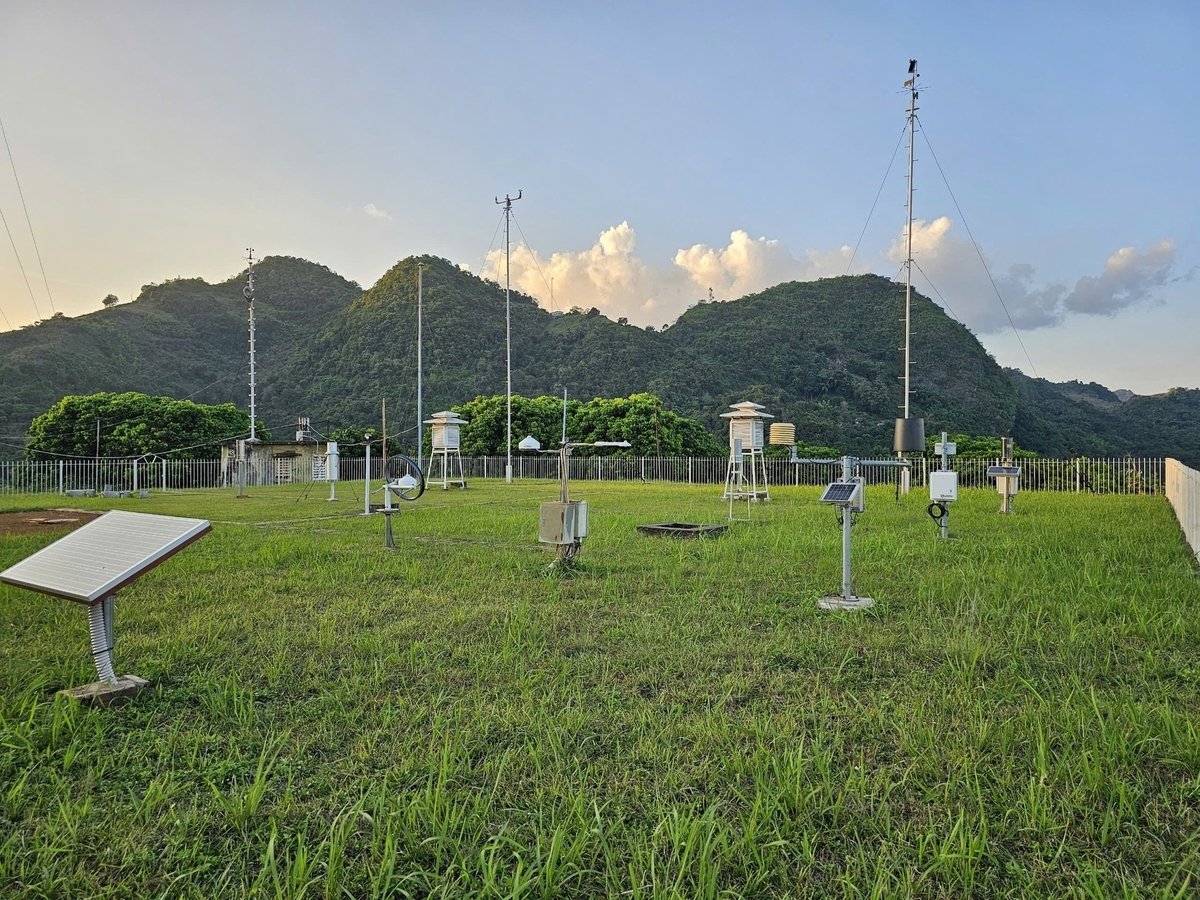
Weather forecasting and warning require close coordination among many units, from observation, data transmission, and analysis to forecasting and information dissemination. Photo: Northern Hydrometeorological Station.
Today, weather forecasting and warning require close coordination among multiple units - from observation, data transmission, and analysis to forecasting and information dissemination. The observation network not only collects meteorological data (wind, clouds, temperature, rainfall) but also extends to hydrology (water levels, flow, water quality), oceanography (waves, tides, currents, temperature, salinity), agricultural meteorology, as well as long-term monitoring of climate change indicators.
These data streams are transmitted to central hubs almost in real time and are combined with satellite imagery, radar, aerial reconnaissance, ocean buoys, shipborne sensors, and aircraft instruments. All of this information is integrated as input for running global, regional, and ensemble forecasting models, which are further refined using forecasters’ experience, statistical methods, and comparisons with actual observations.
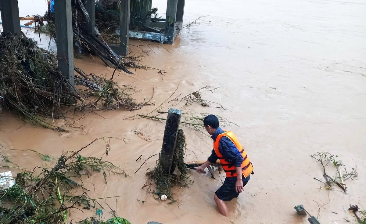
A hydrology station staff member at Thach Giam (Nghe An) clearing debris around gauge posts to measure water levels during the historic flood of July 2025. Photo: Nghe An Meteorological and Hydrological Station.
Throughout this process, specialized divisions in weather, hydrology, marine meteorology, and climate, from the central level to regional and local stations, work in close coordination. At the same time, they exchange information with agencies responsible for disaster prevention, water resources, irrigation, and agriculture to ensure that forecasts are not only accurate but also tailored to practical response needs.
In the final stage, forecasters compile concise, easy-to-understand bulletins that still retain full scientific value. These are then delivered to decision-making bodies, the media, and directly to the public through multiple channels. The guiding principle is to ensure that information is disseminated quickly, accurately, and in a timely manner, even under the most severe disaster conditions.
It is certain that the value of a forecast bulletin lies not only in modern analytical methods, but also heavily depends on the quality of observational data and the coordination among units within the meteorological and hydrological system. Without comprehensive observations and accurate data, even the most advanced forecasting models cannot produce useful bulletins for the public.
What is the current forecasting and warning capacity of Vietnam’s meteorological and hydrological agency after 80 years of establishment and development?
After eight decades of growth, Vietnam’s meteorological and hydrological sector has made remarkable progress in terms of organization, technology, and the quality of forecasting and warning, reaching a leading position within Southeast Asia.
Resolution No. 24-NQ/TW of the 11th Central Committee set the goal of “enhancing disaster forecasting and warning capacity, as well as climate change monitoring, to a level equivalent to the leading countries in the region.” Today, this goal has been largely achieved. This marks the outcome of a comprehensive transformation encompassing institutions, infrastructure, forecasting technologies, and human resources.
Regarding international standing, Vietnam was selected by the World Meteorological Organization (WMO) in 2018 as the Regional Specialized Center for Supporting Hazardous Weather Forecasting in Southeast Asia. In 2022, Vietnam was further entrusted with the role of the Regional Support Center for Flash Flood Guidance in Southeast Asia (SeAFFGS). This affirms Vietnam’s capacity to support neighboring countries in coping with hazardous meteorological and hydrological phenomena.
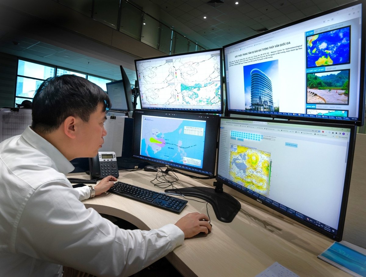
Staff of the National Center for Hydro-Meteorological Forecasting, Vietnam Meteorological and Hydrological Administration, monitoring natural disaster forecasts. Photo: Le Xuan Tung.
In terms of technology, the forecasting system has shifted from manual, experience-based methods to operating high-resolution numerical forecasting systems. The sector has mastered forecasting models with resolutions of up to 3 km and is moving toward 1–2 km, enabling the integration of radar, satellite, automatic observation stations, and international datasets. High-performance supercomputers, capable of tens to hundreds of trillions of calculations per second (TFLOPS), combined with ensemble forecasting and nowcasting technologies, have significantly improved the accuracy and detail of forecasts.
In terms of forecast quality, Vietnam’s accuracy in predicting storm tracks and intensity is now approaching that of advanced countries in the region. Floods, droughts, heatwaves, and cold surges can be forecast well in advance, while heavy rainfall warnings can be issued 2–3 days ahead with around 75% reliability. Forecast bulletins are now more detailed in terms of timing, location, and scope of impact, and they incorporate disaster risk levels. Impact-based forecasting and risk-based warning approaches have also begun to be implemented.
It should be emphasized that forecasting is essentially a probability exercise - an assessment of whether a weather or disaster event is more or less likely to occur. Under the impact of climate change, extreme meteorological, hydrological, and marine phenomena are increasing in both intensity and frequency. Certain types of disasters that occur suddenly, within a narrow scope, such as thunderstorms, whirlwinds, flash floods, and landslides, pose major challenges for forecasting agencies, not only in Vietnam but worldwide.
At the same time, Vietnam still faces several constraints: observation data gaps, particularly in mountainous and island regions; a shortage of highly qualified personnel in forecasting and big data analysis; high costs for maintaining advanced technological systems; difficulties in communicating warnings to remote areas and vulnerable groups; uneven levels of public awareness; and limited mechanisms for cross-sectoral and transboundary data sharing.
Given the growing impacts of climate change and extreme weather, could you share the sector's key priorities and long-term directions, particularly in improving forecast reliability?
The Vietnam Meteorological and Hydrological Administration (VNMHA) identifies hydrometeorology as an essential, continuous, and long-term mission, cross-regional, cross-sectoral, and transboundary, that plays a crucial role in national development and defense. This work requires strong attention from all levels of government, sectors, and society. Meteorological and hydrological information and data are vital inputs for achieving socio-economic development goals, ensuring national security and defense, and serving the daily lives of the people.
In the current context of intensified climate change and extreme weather, the sector is simultaneously focusing on immediate and long-term priorities. These aim to strengthen capacity, master modern technologies, and ultimately enhance the quality and reliability of forecasts and warnings.
The global trend is to accelerate digital transformation in meteorology and hydrology in order to close early-warning gaps and leverage new technologies such as AI, IoT, cloud computing, and 5G/6G. International cooperation and private sector engagement—especially from Big Tech—are providing vital financial and technological resources to strengthen forecasting and warning capacities. Notably, Resolution No. 57-NQ/TW of the Politburo has established a legal framework for modernizing management and applying advanced technologies in disaster warning.
Moving toward a “4.0” warning system, Vietnam’s meteorological and hydrological sector is developing an integrated, intelligent, and people-centered model based on four pillars: Real-time data from observation stations, satellites, and radars applying advanced technologies; Modern forecasting models enhanced by AI to improve reliability; Multi-channel communication through digital platforms and social media; Stronger community outreach, ensuring people understand and respond effectively to warnings.
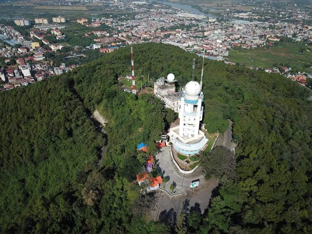
Phu Lien weather radar station, located at Phu Lien Meteorological Station, Hai Phong City. Photo: Hoai Linh.
The Vietnam Meteorological and Hydrological Administration’s upcoming direction is to continue implementing these pillars, integrated with comprehensive digital transformation across three areas:
Operational management based on automation of forecasting tools, applying AI in data processing, option selection, and user demand analysis; building a flexible online forecasting platform.
Institutional and human resource development, focusing on improving regulations, technical standards, and enhancing staff skills, particularly in 4.0 technologies and big data.
Infrastructure investment and international collaboration, strengthening research, and promoting meteorological and hydrological knowledge to the community.
According to the Sector Development Strategy, Vietnam’s meteorological and hydrological sector should reach an advanced level in Asia by 2030 and approach the standards of developed countries by 2045. The aim is to establish an accurate, timely, and targeted forecasting and early warning system that effectively supports disaster prevention and sustainable national development.
Thank you very much, sir!
Translated by Phuong Linh

(VAN) TH Group is implementing multiple solutions to reduce white pollution, notably through the 'Collect Cartons - Spread Green Living' campaign and plastic reduction initiatives.

(VAN) Assoc. Prof. Dr. Nguyen Ngoc Son, a full-time National Assembly deputy serving on the Committee for Science, Technology and Environment, emphasized that agriculture and environment play a strategic role in the green era.

(VAN) Integrated management is the “key” to turning the immense potential of the sea into a driving force for national development, ensuring security, defense, and green, sustainable growth.

(VAN) Viet Nam’s hydrometeorological sector is undergoing strong innovation, aiming for modern, sustainable development and proactive disaster management.

(VAN) Viet Nam is accelerating its conservation efforts for nature and biodiversity, striving for green development, effective management, and community engagement to ensure the sustainable preservation of vital resources.

(VAN) The strengthened cooperation between two organizations, after 30 years of presence in Viet Nam, reflects a long-term commitment to a future where people and nature live in harmony.

(VAN) The International Society of Southeast Asian Agricultural Sciences (ISSAAS) 2025 international seminar, held at the Vietnam National University of Agriculture, brought together scientists from across Asia to discuss solutions for green, low-carbon agriculture development.