October 9, 2025 | 23:23 GMT +7
October 9, 2025 | 23:23 GMT +7
Hotline: 0913.378.918
October 9, 2025 | 23:23 GMT +7
Hotline: 0913.378.918

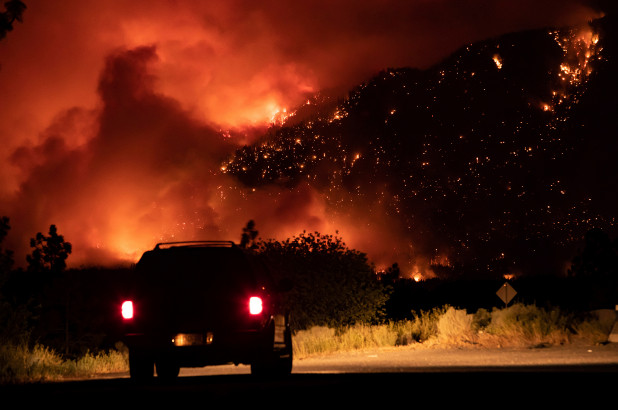
A motorist watches as a wildfire burns on the side of a mountain in Lytton, Canada on July 1, 2021. AP
The majority of the strikes across British Columbia were the result of pyrocumulonimbus clouds, which formed when the blazing heat and billowing smoke from the fires rise skyward, Business Insider reported.
The thunderheads in cumulus clouds produce their own weather, including tornadoes in some cases, which can then spark new fires in a vicious cycle, according to the news outlet.
Dakota Smith, a meteorologist at Colorado’s Cooperative Institute for Research in the Atmosphere, said in a tweet that he observed “absolutely mind-blowing wildfire behavior in British Columbia.”
He included satellite images from above Lytton earlier this week and added: “incredible & massive storm-producing pyrocumulonimbus plumes.”
Daniel Swain, a climatologist with the Institute of the Environment and Sustainability at UCLA, wrote on Twitter: “I’ve watched a lot of wildfire-associated pyroconvective events during the satellite era, and I think this might be the singularly most extreme I’ve ever seen.”
He added: “This is a literal firestorm, producing *thousands* of lightning strikes and almost certainly countless new fires.”
Another name for the “fire clouds” is cumulonimbus flammagenitus, according to NASA, which also refers to the pyrocumulonimbus storms as the “fire-breathing dragon of clouds.”
Thunderstorms normally form when warm, moist air rises into the sky. As it enters the lowest part of the atmosphere, the air cools and sinks closer to the ground, where it warms up and rises again.
That cycle of convection creates cumulonimbus, or thunder, clouds – but when that heat and moisture rise from a smoky wildfire the convection creates pyrocumulonimbus clouds, according to the news outlet.

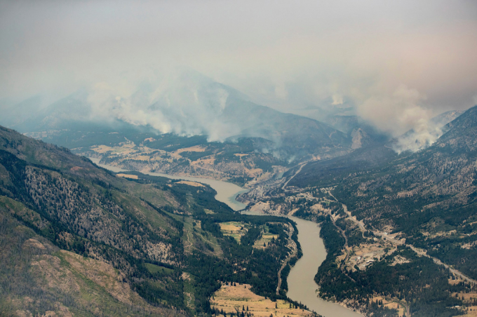
A wildfire burns in the mountains north of Lytton, British Columbia, on July 1, 2021. AP
In addition to rain, these clouds often unleash powerful blasts of dry air known as “downbursts,” rather than water droplets – and scatter a embers and smoke across great distances.
That fuels the flames that originally generated the storm, according to the report.
And if the convecting air in a pyrocumulonimbus cloud forms a swirling, circular column, the storm can also spawn a spectacular “fire tornado,” Business Insider reported.
Chris Vagasky, a meteorologist with Vaisala, which tracks lightning strikes around the world, told SFGATE.com that the North American Lightning Detection Network sensed 710,177 strikes across British Columbia and northwestern Alberta over the course of about 15 hours in recent days.
(NYP;AP)

(VAN) The people who are most vulnerable to the hard-to-breathe air that comes with climate change may inadvertently be adding to the problem, new research finds.

(VAN) Director-General QU Dongyu announces series of initiatives following global livestock conference.

(VAN) China’s freeze on U.S. soybean purchases hits a key GOP constituency in the run-up to 2026 midterm elections.

(VAN) President Xi Jinping's festive greetings ahead of the eighth Chinese Farmers' Harvest Festival, which fell on Tuesday this year, were a clear signal that China regards food security as a core strategic issue.

(VAN) BBNJ Agreement will enter into force in January.

(VAN) Demonstrations have been planned around the world this week ahead of the United Nations General Assembly and New York Climate Week.

(VAN) After years of intense deliberation, the European Commission has finally given its nod to the Mercosur and Mexico agreement.