
In alignment with the guidelines of the Party and the State, the Nghe An Provincial People's Committee has consistently paid great attention to forest protection and biodiversity conservation, closely associated with preserving the traditional cultural values of ethnic minorities in the mountainous regions, aiming for sustainable socio-economic development in western areas of the province.
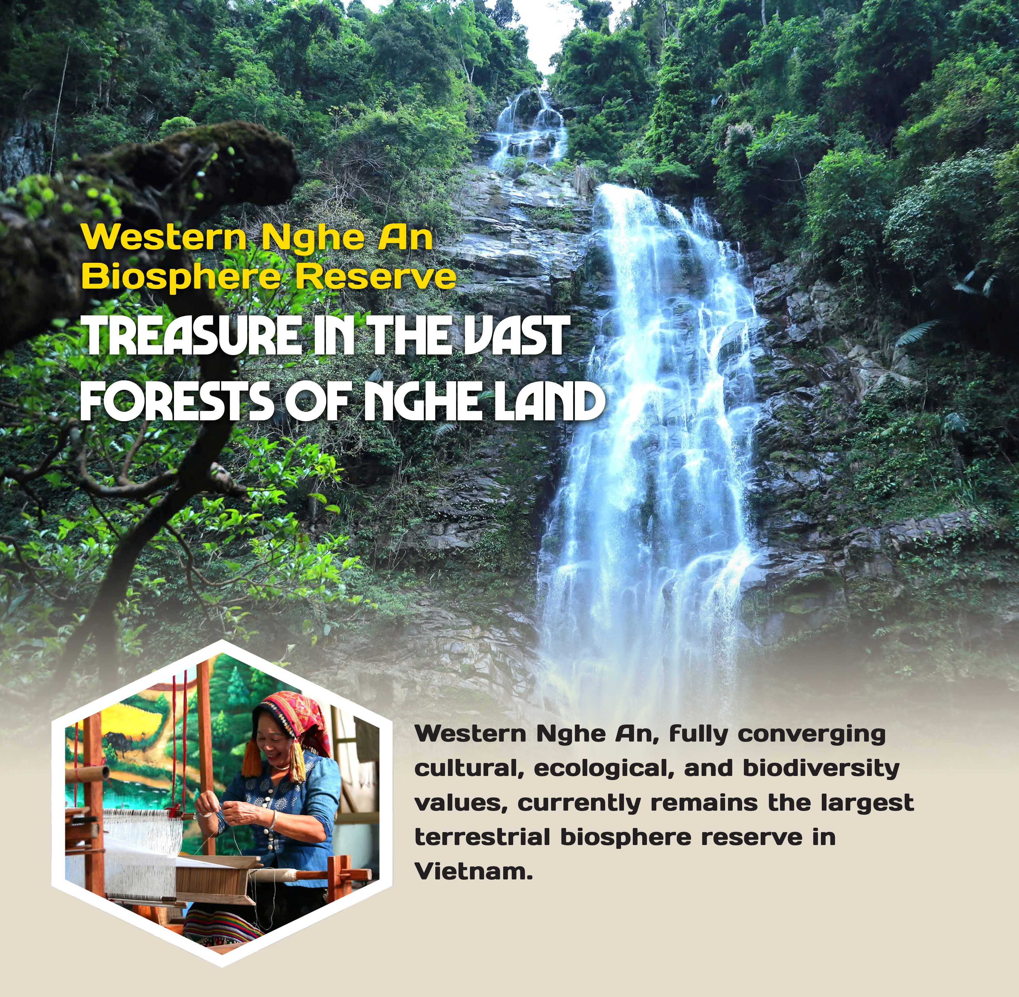
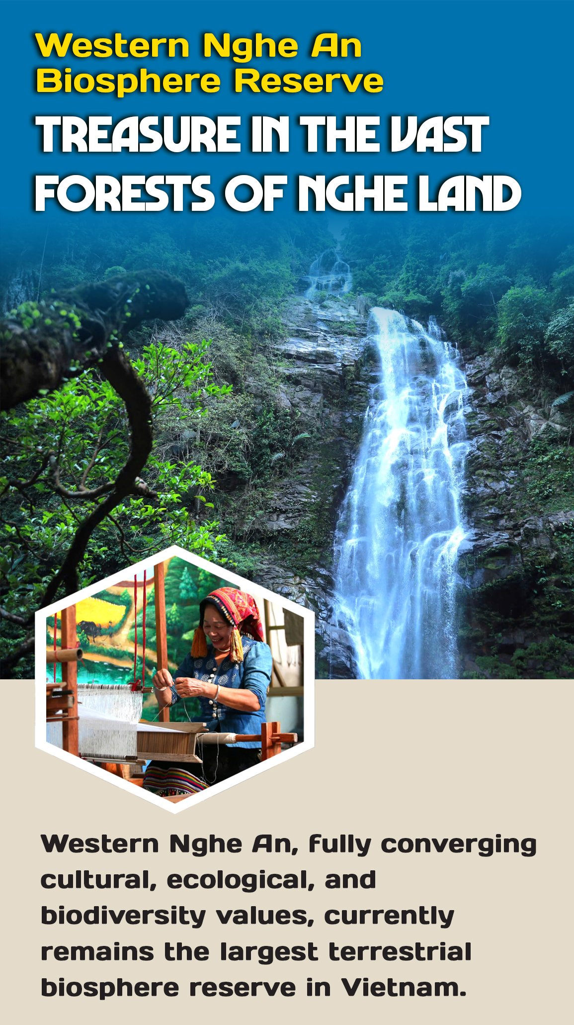
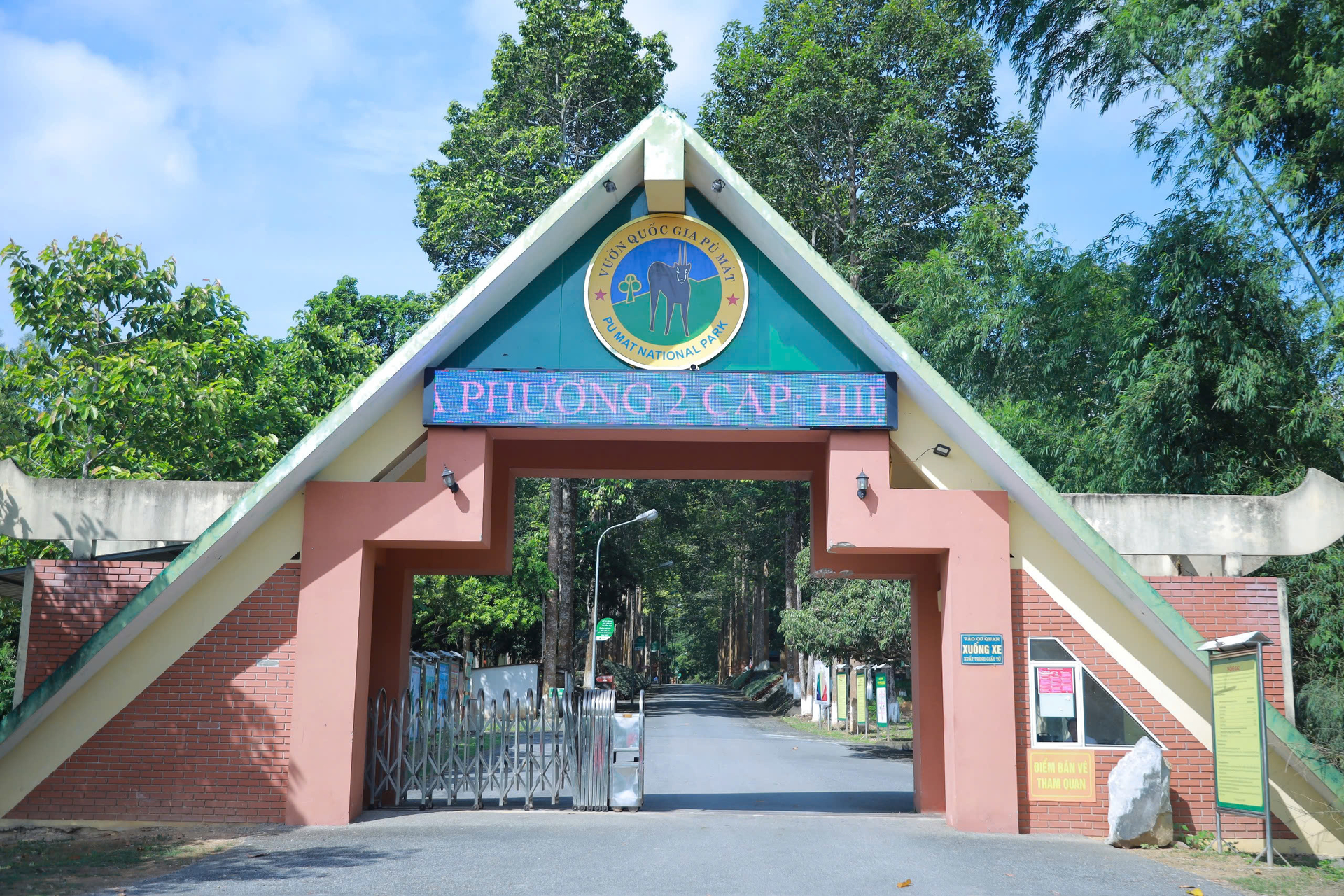
A long journey of tireless efforts was justly rewarded on September 18, 2007, when the United Nations Educational, Scientific and Cultural Organization (UNESCO) officially recognized the Western Nghe An Biosphere Reserve. As of now, this place remains the largest terrestrial biosphere reserve in Vietnam, with an area of 1,299,795 hectares. The reserve serves as a green corridor connecting three special-use forests, including Pu Mat National Park, Pu Hoat Nature Reserve, and Pu Huong Nature Reserve, thereby creating continuous environmental and habitat connectivity.
The biosphere reserve is located in the western part of Nghe An province, stretching along the North–South axis. It encompasses the entire upper basin of the Ca River, including three major tributaries: the Hieu River, the Nam Non River, and the Nam Mo River. The reserve lies within the ecological region of the Annamite Range. Its westernmost point is the summit of Pu Xoi Mountain in Muong Ai commune, former Ky Son district. The northernmost point is the summit of Ban Lien Mountain in Thong Thu commune, former Que Phong district. The southeasternmost point is at the end of the former Thanh Chuong district, bordering the tri-junction with Nam Dan district and former Ha Tinh province.
Before the merger policy was implemented, the biosphere reserve was located within the administrative boundaries of nine mountainous districts, comprising 182 communes and towns and 2,125 hamlets and villages.
After UNESCO’s recognition, the Nghe An Provincial People's Committee issued Decision No. 5232/QD-UBND, dated November 5, 2013, on the establishment of the Western Nghe An Biosphere Reserve Management Board, tasked with managing and coordinating overall activities.
The Western Nghe An Biosphere Reserve is divided into three distinct functional zones to ensure multiple objectives, both conserving and rationally, harmoniously utilizing natural resources.
Among them, the core zone covers an area of 168,301 hectares with a population of nearly 1,000 people. It includes Pu Mat National Park and two Pu Huong and Pu Hoat Nature Reserves, spanning the districts of Con Cuong, Tuong Duong, Que Phong, Quy Chau, and former Quy Hop.
Meanwhile, the buffer zone has an area of 608,547 hectares and a population of over 314,200 people, located in the districts of Con Cuong, Tuong Duong, Que Phong, Quy Chau, Quy Hop, Ky Son, Anh Son, and former Thanh Chuong. Lastly, the transition zone spans nearly 522,950 hectares with a population of approximately 611,900, falling under the administrative boundaries of the districts of Con Cuong, Tuong Duong, Que Phong, Quy Chau, Quy Hop, Ky Son, Anh Son, Thanh Chuong, and former Tan Ky.

The Western Nghe An Biosphere Reserve is a mixture and interweaving of multiple floras, fully converging paleo-tropical, subtropical, sub-temperate, and temperate elements. The entire area contains all four formation layers: closed forest, open forest, shrubs, and herbs. In the reserve, there are 12 characteristic ecosystems, most of which is the tropical monsoon evergreen closed forest.
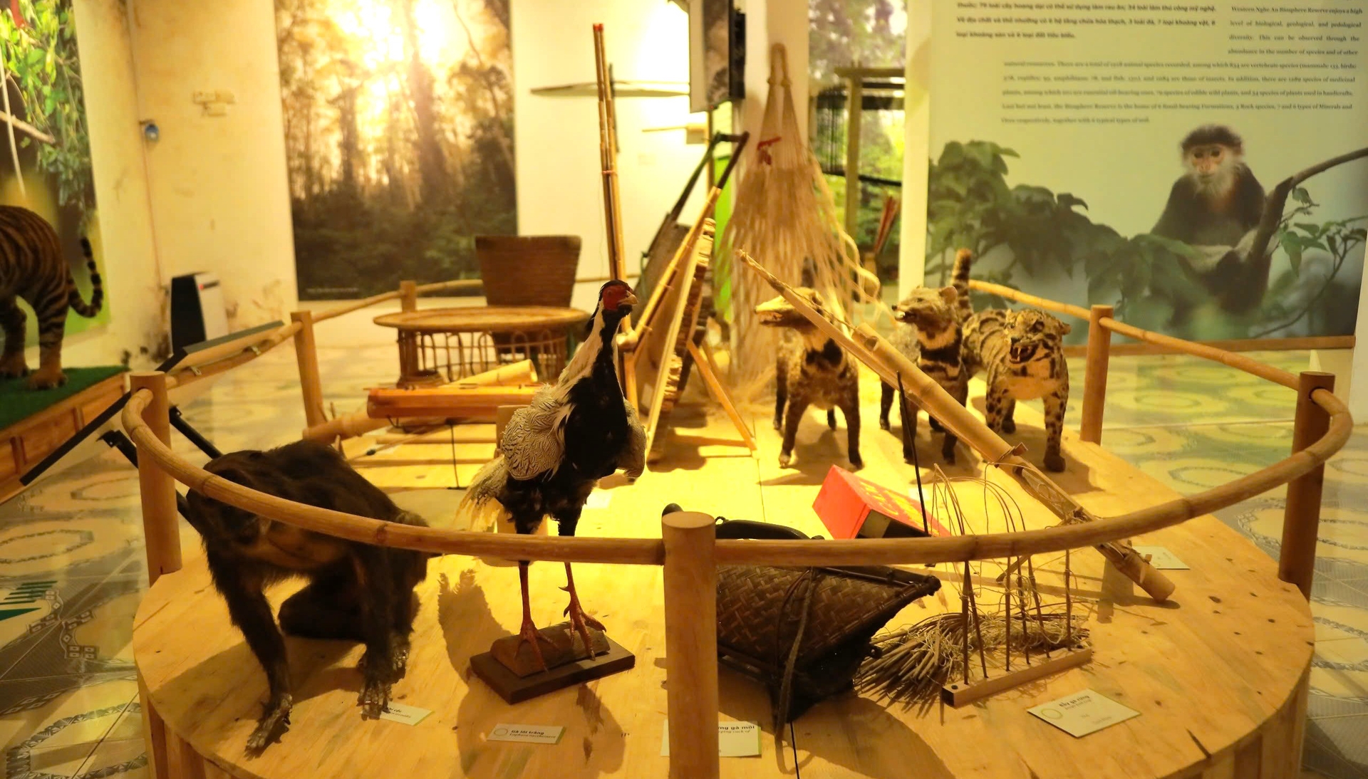
Research and statistical results show that the Western Nghe An Biosphere Reserve is rich and diverse in species, with the presence of numerous rare and precious ones making it even more remarkable. Within the boundaries of Pu Mat National Park alone, 2,494 species of higher plants, belonging to 941 genera and 202 families, have been identified, along with 662 species of vertebrates across 35 orders and 109 families. Among these, 76 plant species are listed in the Vietnam Red Data Book, and 68 species are listed in the Red List of the International Union for Conservation of Nature (IUCN). In terms of animals, 85 species are listed in the Vietnam Red Data Book, and 420 species are listed in the IUCN Red List (2007).
Among the notable rare animals is the Asian elephant (scientific name: Elephas maximus), a large mammal belonging to the order Proboscidea. This elephant species typically inhabits secondary forests, deciduous forests, bamboo forests, and mixed timber–bamboo forests. Elephants live in herds with tight social structures and exhibit strong protective behaviors toward their fellow members.
In the past, Nghe An province had a relatively large elephant population. However, due to various factors, such as ivory hunting and domestication to serve timber exploitation and exports by forest enterprises, the elephant population has drastically declined. Currently, only 13 to 17 individuals remain in the wild, distributed across three areas: the core and buffer zones of Pu Mat National Park and the core and buffer zones of Pu Huong and Pu Hoat Nature Reserves, all situated on the forest stretch of the Annamite Range.
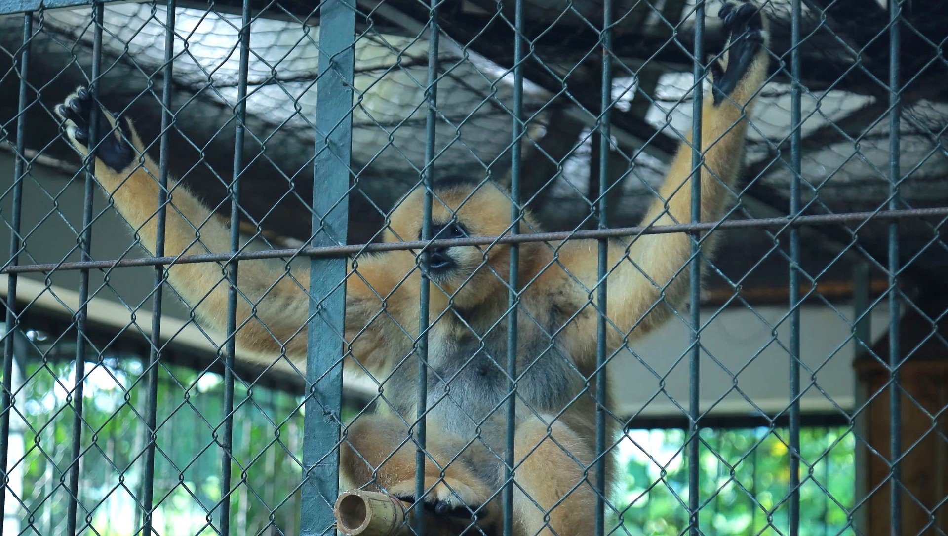
Another significant species is the red-shanked douc (Pygathrix nemaeus), characterized by its multicolored fur, black crown and forehead, and dense facial fur forming a mask from white-gray to gray. Its neck and chest are red, ranging from bright to pale shades. Its back is light gray or speckled. This species is listed in both the Vietnam Red Data Book and the list of flora and fauna strictly prohibited from exploitation and trade under Decree 32/HDBT (dated March 30, 2006). The red-shanked douc is currently under conservation and is completely prohibited from exploitation in Pu Mat National Park.
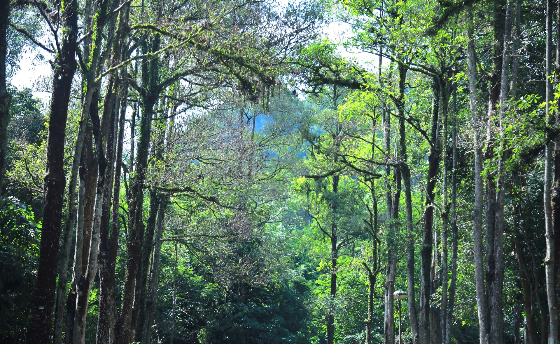
It is not wrong to describe the Western Nghe An World Biosphere Reserve as a “convergence of Vietnam’s heritage trees.” One example is the Cunninghamia konishii tree at Pu Mat National Park, recognized by the Vietnam Association for Conservation of Nature and Environment (VACNE) as a “Vietnamese Heritage Tree.” This tree has grown for centuries upstream of Khe Bu, with a sparse, narrow conical canopy. Its trunk is straight, with a height of approximately 70 meters, a circumference of 23.7 meters, and a diameter of 5.4 meters.
Another remarkable example is the millennia-old weeping fig tree in Giai Xuan commune, Tan Ky district. The tree has a height of 27 meters and a canopy spanning 35 meters. Its base and trunk embrace two granite boulders with shapes symbolizing the legend of Chung Cake and Day Cake. The largest boulder lies on the ground in a rectangular shape, has a length of nearly 10 meters, and is surrounded by four roots as large as a human embrace plunging straight into the earth.
Also on the list of conservation priorities is a population of rare Cunninghamia konishii and Duabanga grandiflora trees in Pu Hoat Nature Reserve, located in Hanh Dich commune, former Que Phong district, at an altitude of over 1,700 meters. In June 2016, VACNE conducted a review process and officially recognized 56 Cunninghamia konishii trees in Sub-zone 60 and 5 Duabanga grandiflora trees in Sub-zone 59 in Hanh Dich commune as Vietnamese Heritage Trees.
According to scientists, similar to the Cunninghamia konishii tree in Pu Mat National Park, the Cunninghamia konishii population in Pu Hoat Nature Reserve is a rare population, classified as an endangered plant species. With their heights surpassing the towering canopy in natural forests, these trees stand as majestic symbols of Vietnam’s flora.
Based on survey and statistical results, the Western Nghe An Biosphere Reserve is regarded as a “shared home of six ethnic groups.” Among them, the Thai ethnic group includes the Man Thanh, Hang Tong, and Tay Muoi subgroups, all belonging to the Tay–Thai language family. The Tho ethnic group comprises subgroups like Cuoi, Mon, Dan Lai–Ly Ha, and Tay Poong, which belong to the Viet–Muong language family. The Kho Mu and O Du ethnic groups belong to the Mon–Khmer language family, while the Mong ethnic group, consisting of White Mong and Black Mong subgroups, belongs to the Hmong–Dao language family.
Since ancient times, ethnic minorities have mainly concentrated in highland districts such as Ky Son, Tuong Duong, Con Cuong, Que Phong, Quy Chau, and Quy Hop, while others reside in lower mountainous districts like Nghia Dan, Tan Ky, and Anh Son. The Western Nghe An Biosphere Reserve marks the southernmost point of Mong settlement.
According to the survey, the Mong people have lived in the mountainous areas of Nghe An for around 200 years. They usually reside in places with an altitude of 800 meters or more, primarily in Ky Son district and several communes of Que Phong and Tuong Duong districts.
The Kho Mu people migrated to the mountainous areas of Nghe An a few hundred years ago. They typically live at the headwaters of streams within the Lam River basin, in mid-mountain regions between the Mong and the Thai communities. This group is concentrated mainly in Ky Son, Tuong Duong, and Que Phong districts.
The Thai ethnic group represents the largest population and plays a vital role in transforming the landscape of Nghe An’s mountainous areas throughout history. The Thai people are present in nearly all midland and mountainous districts of Nghe An province. Following the resettlement program associated with the construction of the Ban Ve hydropower plant in Tuong Duong, more than 2,000 Thai households were relocated to Thanh Chuong district in the 2009-2010 period, establishing two new communes of Ngoc Lam and Thanh Son.

Meanwhile, the Tho ethnic group has recently formed for 100–150 years. The Keo and Ho subgroups reside in Nghia Dan district; the Cuoi subgroup in Nghia Dan and Tan Ky districts; the Dan Lai–Ly Ha subgroup in Con Cuong; and the Tay Poong in Tuong Duong.
The O Du are the smallest ethnic group in Nghe An. They live in Vang Mon village, Nga My commune, Tuong Duong district.
Ethnic minorities in Western Nghe An is divided into two main groups, residing in two distinct areas: the Northwestern mountains (along National Highway 48) and the Southwestern mountains (along National Highway 7). A distinctive feature is that although each ethnic group may consist of various subgroups, they are able to live together in harmony and coexist naturally.
Bilingualism and multilingualism are relatively popular, with the Thai language considered the “common language” among ethnic communities. Interethnic relations have developed naturally and sustainably and have close ties with Lao ethnic groups.

Stretching across the Western Nghe An Biosphere Reserve are dozens of unique relics and landscapes, converging values in terms of landscape, nature, culture, and history, and highly evaluated by experts, scientists, and tourists.
The first destination is the Tea Island in Thanh Chuong district, located about 55 kilometers from Vinh city. Following the Ho Chi Minh Trail through Thanh An commune, a short 10-minute motorboat ride takes tourists to the heart of Cau Cau Dam, where the view opens up to green tea islands winding and wrapping around the spacious waters.
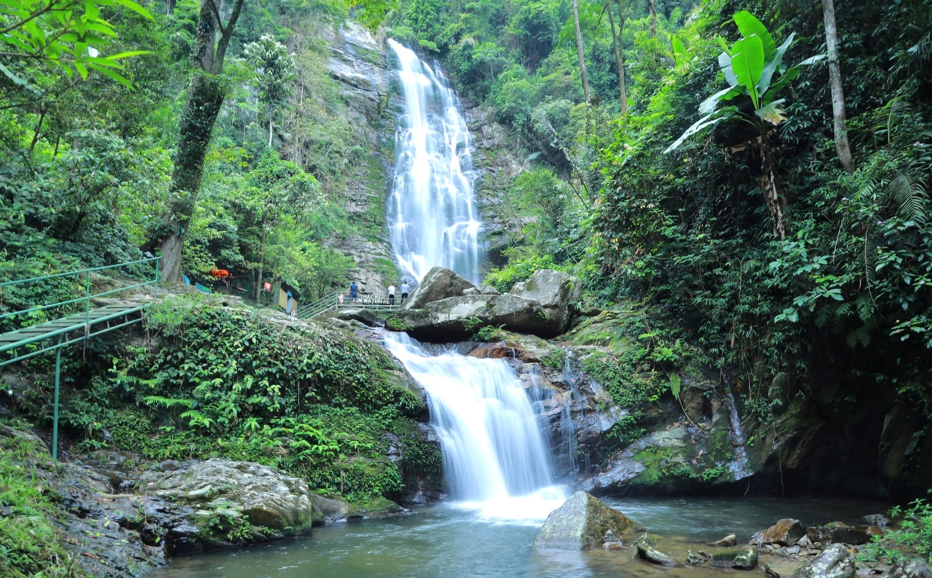
Another masterpiece bestowed upon the vast forests of Nghe land by nature is Khe Kem Waterfall, nestled in Pu Mat National Park. Cascading from a height of 500 meters, the clear, icy waters fall over three tiers, blanketing the area in white spray. From a distance, Khe Kem Waterfall resembles a soft, white silk ribbon, standing out amid the majestic mountains.
From the base of the waterfall, tourists can follow a trail to reach its summit for the pristine beauty of mountains and forests. Alternatively, tourists make their way to Khe Bu Valley or trek to Pu Loong Mountain, which takes approximately 6-8 hours for a round trip. It is also worth noting that, thanks to state investment, a long, smooth asphalt road now stretches from Con Cuong town to the base of the waterfall, promising to significantly enhance the status of the Khe Kem Waterfall tourist destination in the near future.
Con Cuong district also has the Ma Nhai Stele and the ancient Tra Lan Citadel in Bong Khe commune. According to history books, in 1335, Emperor Tran Minh Tong led an expedition into the Nam Nhung region (now Western Nghe An) to suppress Ai Lao invaders and secure the borderlands.
Following the victory, Emperor Tran Minh Tong assigned royal scholar Nguyen Trung Ngan to have soldiers smooth the rock face on Thanh Nam Mountain, located in Tuong Duong (now Chi Khe commune, Con Cuong district), to carve a stele commemorating the victories of the Tran Dynasty. The stele, known as Ma Nhai Ky Cong Bi Van (Ma Nhai Stele), has experienced nearly 700 years of change, yet the ancient inscriptions remain intact, preserving their historical value.
The Ma Nhai Stele has 14 lines with 155 characters, etched deep into a limestone cliff facing the Lam River. This is a testament to the heroism and territorial protection spirit of the ancestors. In July 2011, the Ministry of Culture, Sports and Tourism recognized the Ma Nhai Stele as a National Historic and Cultural Site.
Meanwhile, across the Lam River from Pu Mat National Park lies the site of Tra Lan Citadel in Tan Hoa Village, Bong Khe Commune.
This is a land steeped in heroic history, once part of Tra Lan Palace, one of the eight palaces of Nghe land. According to the Complete Annals of Dai Viet, in the 13th century, Con Cuong district was known as Nam Nhung or Kiem Chau, later renamed Mat Chau. During the Ming occupation in 1406, Vietnam was renamed Giao Chi district, and Mat Chau was renamed Tra Long, then Tra Thanh. Under the Later Le Dynasty, this land was called Tra Lan, which was the capital of the northwestern region of Nghe land and the site of the resounding Battle of Tra Lan during the Lam Son Uprising, celebrated by national hero Nguyen Trai in his immortal proclamation Binh Ngo Dai Cao:
“The Battle of Bo Dang thundered with lightning strikes,
The land of Tra Lan saw bamboo split and ashes fly.”
After more than 600 years of exposure to sun and rain, natural disasters, and human impact, Tra Lan Citadel has been largely destroyed, with only a few remnants still remaining.
Heading up into the mountains leads tourists to the paradise of Muong Long, often likened to the "heaven's gate of Nghe An," located in the highland district of Ky Son at an altitude of over 1,485 meters above sea level. In the Thai language, "Muong Long" or Lống Tang means "Lose Way," referring to the lost to a fairyland that is so mesmerizing and captivating that one forgets the way back.
During the cold season, Muong Long is shrouded in mist like a shy maiden veiled behind a curtain of velvet. When the warm sunshine returns, hundreds of flowers burst into bloom, filling the air with vibrant life and renewed energy. This place also offers tourists the opportunity to explore the unique cultural identity of the Mong ethnic group. In Muong Long, tourists should not miss the highland markets, which are held only twice a month, at the beginning and in the middle of each month. For the Mong people, going to the market is primarily to meet and socialize, rather than focusing on trade or making a living. If Ky Son is likened to a multicolored painting, then Muong Long will be its most emotionally evocative brushstroke.