November 27, 2025 | 14:43 GMT +7
November 27, 2025 | 14:43 GMT +7
Hotline: 0913.378.918
November 27, 2025 | 14:43 GMT +7
Hotline: 0913.378.918
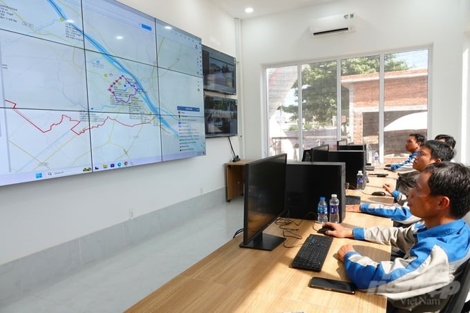
Can Tho City's ODA Project Management Board recently organized a demonstration of the operation of the flood risk management information system (FRMIS) under the Can Tho Urban Development and Resilience Enhancement Project. This is the final demonstration before putting the system into official operation.

Technical staff are testing the flood risk management information system (FRMIS). Photo: Kim Anh.
The construction of the FRMIS system has provided many support tools, creating a smart, modernized, and integrated city approach to urban flood risk management.
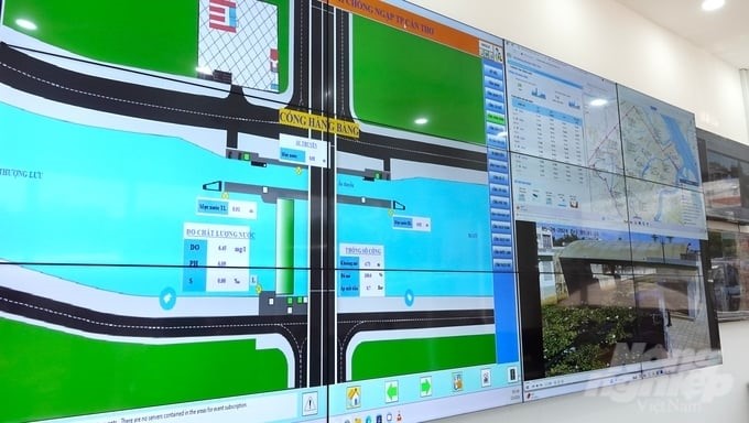
The FRMIS system includes four main functions: operation, water source control, and flood prevention; early warning information; creating a flood risk map; and supporting urban planning work.
The system is installed in the control room of the operating house, adjacent to the water navigation and Cai Khe sluice. FRMIS has the ability to predict water levels, rainfall, etc., thereby simulating, providing early warnings of locations likely to be flooded, and opening and closing sluices.
The FRMIS system is operated completely automatically through control from the operating house; all information is displayed on the screen for remote control. Putting the system into operation will immediately reduce damage caused by flooding for city residents.

The FRMIS system has the ability to predict water levels, rainfall, etc., thereby providing early warnings of locations likely to be flooded and opening and closing sluices. Photo: Kim Anh.
According to the representative of Can Tho City's ODA Project Management Board, FRMIS is the first smart, modern flood risk management system in Vietnam. When put into operation, the FRMIS system will perform the work of operating and managing natural disasters in general and flood risks in particular in accordance with the integrated flood risk management strategies for the city identified in Can Tho City Planning for the 2021–2030 period, with a vision to 2050.
Mr. Nguyen Thuc Hien, Vice Chairman of the Can Tho City People's Committee, said that the city pays great attention to perfecting this operating system. Mr. Thien requested that the ODA Project Management Board soon put the system into operation before June 30. At the same time, Mr. Thien hopes experts will support Can Tho City officials in operational testing to become proficient before handing over the system.

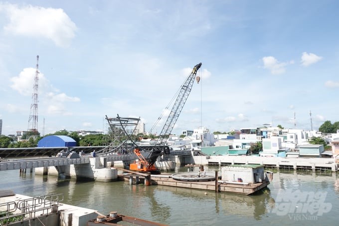
The Can Tho Urban Development and Resilience Enhancement Project has made about 80% progress. Photo: Kim Anh.
The Vice Chairman of the Can Tho City People's Committee assigned the Department of Construction to be the focal unit, performing general operation and maintenance for the entire system. The Department of Agriculture and Rural Development is responsible for operating the water management works (cell system, tide control sluice, pumping station, etc.) formed in the project.
Can Tho City’s ODA Project Management Board said that the FRMIS system is one of the items under the Can Tho Urban Development and Resilience Enhancement Project. The project includes three components, with a total capital investment of USD 254 million from capital from the World Bank, non-refundable aid capital from the Swiss State Secretariat for Economic Affairs (SECO), and reciprocal capital from the central and local governments.

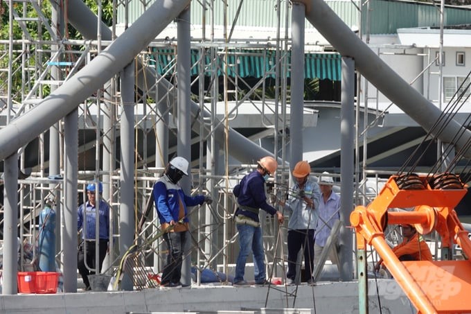
Workers are urgently constructing to ensure project progress. Photo: Kim Anh.
Can Tho City identify that this is a project of important significance to the city's urban development. In addition to urban development and enhancing connectivity between the city center and newly developed urban areas, the project also serves local economic and social development. At the same time, support strengthening the government's capacity to integrate shared data, manage natural disaster risks, and protect the city's core area from flood risks.
As of now, the project has made about 80% progress. Some basic items have been completed, such as embankments, sluices, water navigation, and pumping stations to protect along the Can Tho River; the 10-km Cai Son-Muong Khai embankment, contributing to flood prevention for the urban core area and creating an environmental landscape; road and bridge structures to facilitate transportation; and connecting urban traffic axes to reduce travel time between inner-city areas.
Translated by Thu Huyen

(VAN) On the morning of November 27 in Beijing, Minister Tran Duc Thang and the Deputy Commissioner General of the General Administration of Customs of China signed a protocol on fresh jackfruit exports.

(VAN) As floodwaters recede, a vast network of irrigation works across eastern Gia Lai is emerging in a state of severe disrepair, with extensive damage demanding urgent restoration ahead of the 2025-2026 winter-spring cropping season.

(VAN) The conference reviewing three years of implementing Decision 911 identified the need to prioritize improving marine environmental quality and promoting sustainable fisheries development.

(VAN) Le Hoai Trung, Member of the Communist Party of Viet Nam Central Committee and Minister of Foreign Affairs, held talks with Vi Thao, Chairman of the Guangxi Zhuang Autonomous Region (China) this week.

(VAN) The Mekong River Commission adopts the 2026 - 2030 Strategic Plan with a people-centered approach.
/2025/11/26/1720-1-200855_132.jpg)
(VAN) Viet Nam and Japan have many conditions to expand cooperation on climate change adaptation, particularly in disaster risk management based on advanced technologies.

(VAN) The strong development of digital technology and artificial intelligence is opening up opportunities to transform science and technology into a 'Magic eye' for disaster forecasting and early warning.